TRIS logo image
Search275,000+ actors, artists, objects, artworks, films, exhibitions, archives

EN

EN

English

HI

Hindi

EN

EN

English

HI

Hindi

Tuli Research Centre for India Studies

Tuli Research Centre for India Studies

Vision

Manifesto

Archive & Library

Vanraja Sanctuary & Hospice

Home

Research Categories

Browse All

ICore

1_CinemaEducation_Cinema as a Critical Educational Resource

2_FineArts_Modern and Contemporary Indian Fine Arts

3_Photography_Photography in India

4_PopCulture_The Printed Image, Popular Arts, and Crafts

IIMaterial

5_ArcHeritage_India's Architectural Heritage as Inspiration

6_EconomicsArt_Economics of Art & Cultural Industry

7_Travel_Automobile, Transport and Travel Heritage

8_Uncertainty_Uncertainty

IIICritical

9_SocialDuty_Social Responsibility of the Creative Mind

10_Childhood_The Changing Smile of Childhood & Its Second Coming

11_Sensuality_The Sensual Discipline within Creativity

12_Scholarship_The History & Historiography of Scholarship in the Arts, Humanities, and Social Sciences

IVMeaningful

13_SeekJustice_Seeking Justice and Political Integrity

14_IndoWorld_India and her Relationship with the World

15_SpiritualPoetics_The Religious-Spiritual-Poetic-Philosophical Framework

16_Continuum_The Animal-Human-Nature Continuum

Explore

All

Posts

Masterlists

Calendar

Live | Upcoming

All Events

Timetable

Search275,000+ actors, artists, objects, artworks, films, exhibitions, archives

EN

EN

English

HI

Hindi

Maps, Surveys, Battleplans & Coastal Views

Maps, Surveys, Battleplans & Coastal Views

Theme.Categorised Group of Objects
On this Page
Introduction
Research Centre23
All23
Archive23
Home/2_FineArts/Theme · Categorised Group of Objects/Maps, Surveys, Battleplans & Coastal Views
Maps, Surveys, Battleplans & Coastal Views — featured artwork

Introduction

Printed maps, surveys, battleplans, and coastal views were vital tools in the 17th to 19th centuries for navigation, military strategy, and geographical understanding. Maps provided detailed representations of regions for travel or trade, while surveys offered precise land measurements, often for property or colonial administration. Battleplans depicted troop movements and strategies during historic conflicts, serving both military and historical records. Coastal views, often artistic yet functional, helped sailors identify shorelines and harbors from sea. All were typically engraved or lithographed on paper, combining technical detail with artistic skill, and are now prized as historical documents and collectibles.

Research Centre
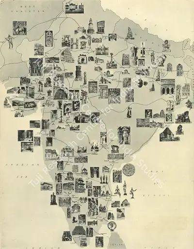
Unknown (Cartographer), Heritage Monuments and Sites in India, 1951, Map
Unknown (Cartographer). Heritage Monuments and Sites in India, 1951 | Map
View full record
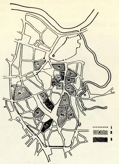
Unknown (Cartographer), Plan of the historicalcore of Vilnyus, Map
Unknown (Cartographer). Plan of the historicalcore of Vilnyus, n.d. | Map
View full record
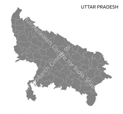
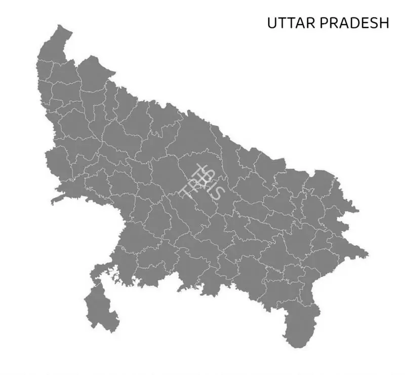
Unknown (Cartographer), Uttar Pradesh, Map
Unknown (Cartographer). Uttar Pradesh, n.d. | Map
View full record
Unknown (Cartographer), Nasik, Map
Unknown (Cartographer). Nasik, n.d. | Map
View full record
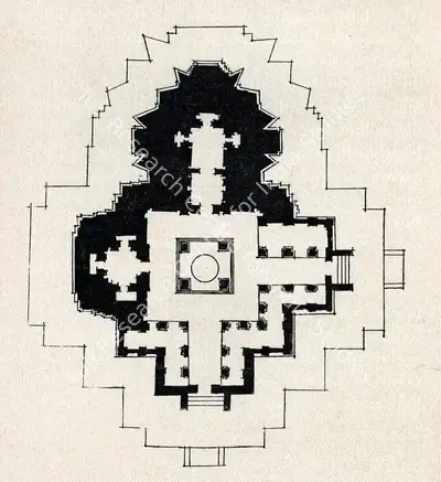
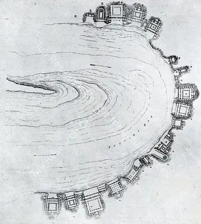
Unknown (Cartographer), Plan of Kesava Temple, Belur, Map
Unknown (Cartographer). Plan of Kesava Temple, Belur, n.d. | Map
View full record
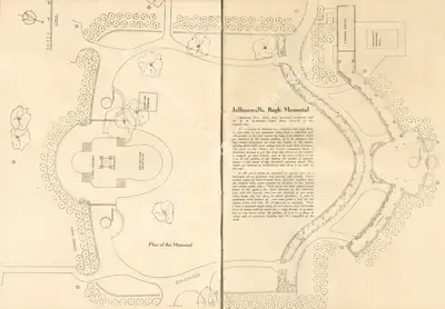
Unknown (Cartographer), Plan of the Memorial, Map
Unknown (Cartographer). Plan of the Memorial, n.d. | Map
View full record
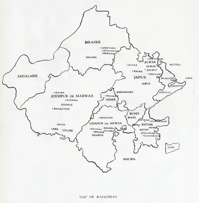
Unknown (Cartographer), Map of Rajasthan, Map
Unknown (Cartographer). Map of Rajasthan, n.d. | Map
View full record
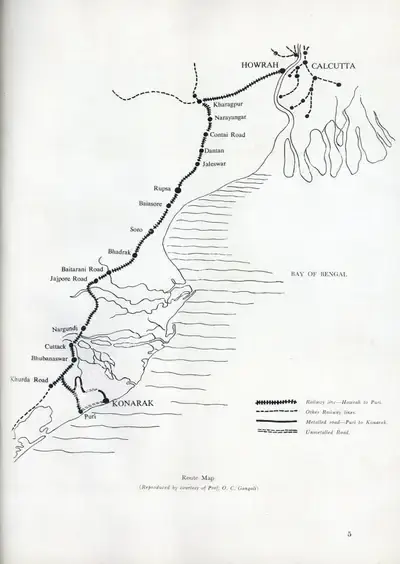
Unknown (Cartographer), Route Map, Map
Unknown (Cartographer). Route Map, n.d. | Map
View full record
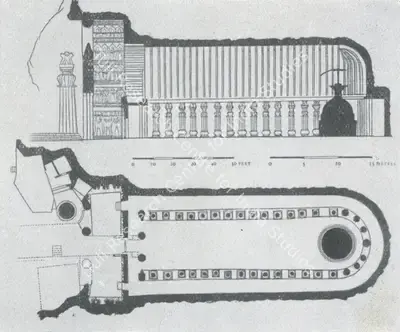
Unknown (Cartographer), Karle, Map
Unknown (Cartographer). Karle, n.d. | Map
View full record
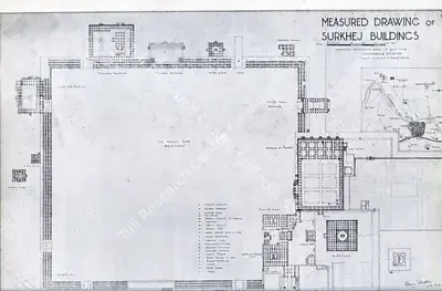
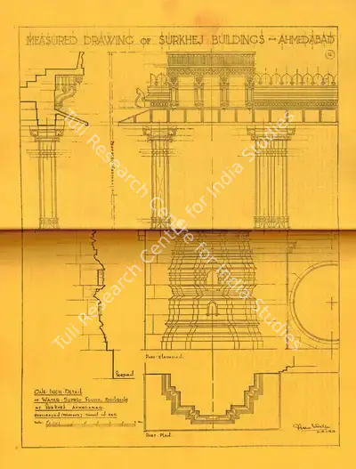
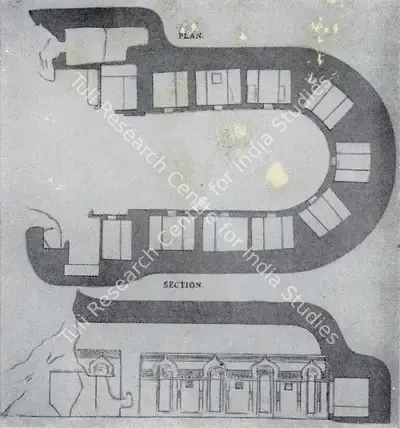
Unknown (Cartographer), Measured Drawing of Surkhej Buildings, Map
Unknown (Cartographer). Measured Drawing of Surkhej Buildings, n.d. | Map
View full record
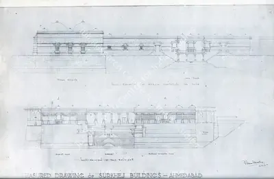
Unknown (Cartographer), Measured Drawing of Surkhej Buildings, Map
Unknown (Cartographer). Measured Drawing of Surkhej Buildings, n.d. | Map
View full record
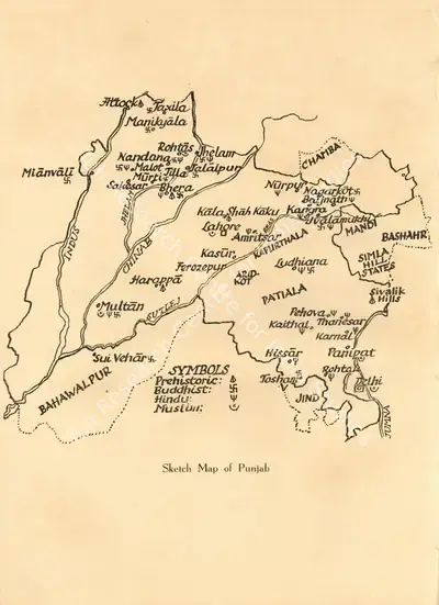
Unknown (Cartographer), Sketch Map of Punjab, Map
Unknown (Cartographer). Sketch Map of Punjab, n.d. | Map
View full record
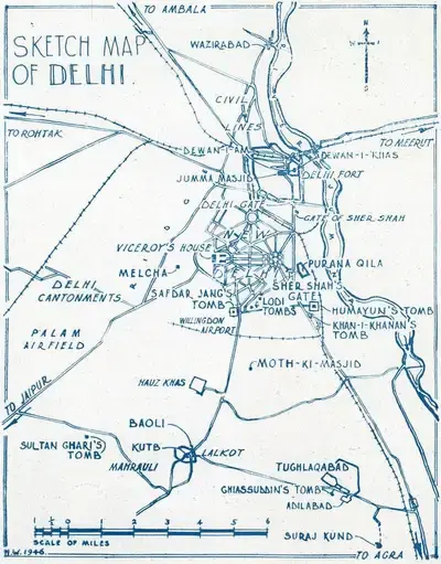
Unknown (Cartographer), Old Delhi, Map
Unknown (Cartographer). Old Delhi, n.d. | Map
View full record
Unknown (Cartographer), Measured Drawing of Surkhej Buildings, Map
Unknown (Cartographer). Measured Drawing of Surkhej Buildings, n.d. | Map
View full record
Unknown (Cartographer), Bedsa, Map
Unknown (Cartographer). Bedsa, n.d. | Map
View full record
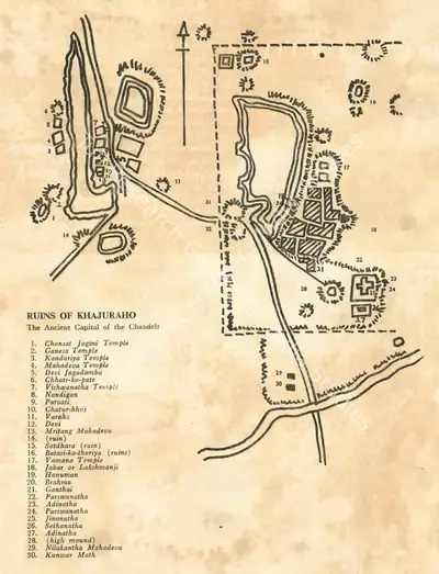
Unknown (Cartographer), Ruins of Khajuraho, Map
Unknown (Cartographer). Ruins of Khajuraho, n.d. | Map
View full record
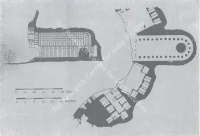
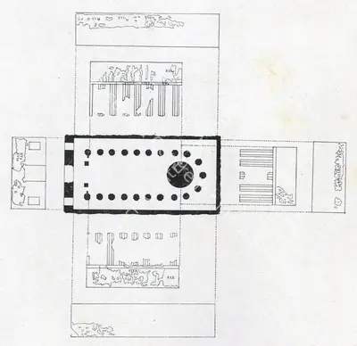
Unknown (Cartographer), Bhaja Plan, Map
Unknown (Cartographer). Bhaja Plan, n.d. | Map
View full record
Unknown (Cartographer), General Plan of Ajanta Caves 1-28, Map
Unknown (Cartographer). General Plan of Ajanta Caves 1-28, n.d. | Map
View full record
Unknown (Cartographer), Ajanta, Map
Unknown (Cartographer). Ajanta, n.d. | Map
View full record
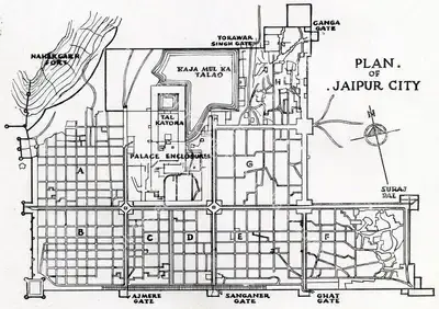
Unknown (Cartographer), Plan of Jaipur City, Map
Unknown (Cartographer). Plan of Jaipur City, n.d. | Map
View full record
20 of 23

Related

3

Themes

2

Journal of Arts & IdeasComparable Artworks
MargComparable Artworks

Locations

1

LucknowComparable Artworks
Tuli Research Centre for India Studies

Tuli Research Centre

for India Studies

A free and open knowledge base for the modern and contemporary Indian arts, cinema, photography and cultural heritage.

Support

Contact Us

Discover

Tuli Research Centre for India StudiesVisionManifestoArchive & LibraryVanraja Sanctuary & Hospice

Legal

Privacy PolicyTerms & Conditions

Follow us

Youtube

Youtube

Instagram

Instagram

Facebook

Facebook

© Tuli Research Centre for India Studies 2026

Tuli Research Centre for India Studies

Tuli Research Centre

for India Studies

A free and open knowledge base for the modern and contemporary Indian arts, cinema, photography and cultural heritage.

Tuli Research Centre for India StudiesVisionManifestoArchive & LibraryVanraja Sanctuary & Hospice
Contact Us
Privacy PolicyTerms & Conditions

Follow us

YoutubeInstagramFacebook

© Tuli Research Centre for India Studies 2026

              Unknown (Cartographer). Uttar Pradesh. n.d. | Map  | 00675517

              Unknown (Cartographer). Uttar Pradesh, n.d. | Map

              Cartographer Unknown
              Document TypeMap
              Daten.d.
              TitleUttar Pradesh
              DescriptionHigh Quality map of Uttar Pradesh is a state of India, with borders of the districts

              Research Categories

              7_Travel
              Copyright of ImageRefer to Source
              Source
              https://www.istockphoto.com/vector/%C3%B0%C3%B0%C3%B1-%C3%B0%C3%B0%C3%B1%C3%B0%C2%B5%C3%B1%C3%B0%C3%B0%C2%B5%C3%B1%C3%B0-gm1143696504-307233869
              WNN
              00675517

              Related Links3

              Masterlist2
              LucknowPrint Maps Surveys Battleplans Coastal Views
              Research Categories
              07Automobile, Transport and Travel Heritage